Bali is an Indonesian island located at 8°25′23″S, 115°14′55″ECoordinates: 8°25′23″S, 115°14′55″E, the westernmost of the Lesser Sunda Islands, lying between Java to the west and Lombok to the east. It is one of the country's 33 provinces with the provincial capital at Denpasar towards the south of the island. The island is home to the vast majority of Indonesia's small Hindu minority. It is also the largest tourist destination in the country and is renowned for its highly developed arts, including dance, sculpture, painting, leather, metalworking and music.
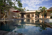
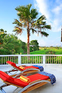
Bali on the map seems such a small island. Indeed it covers a small area of just 5,620 square kilometres, and is one of the smallest islands in the Indonesian archipelago. However, it is a great mistake to think that you can see all of Bali in a couple of days. Apart from a stunning range of scenery that varies every view kilometres and amaze of criss-crossing roads to explore there are thousands of places of interest to discover, and a culture and lifestyle full of exciting events to witness.